Life Verse:

"...I have come that they may have life and that they may have it more abundantly." -- JESUS in John 10:10

Thursday, August 25, 2011

Hiking Destination: Everglades National Park

While this article from NatGeo highlights the hiking possibilities in Everglades National Park (and I'm certain I would enjoy hiking there), my first thoughts about this mysterious area are exploring the hidden spots by kayak!  Certainly one to add to my List...

Everglades-national-park-mangrove_37651_600x450
By Kate Siber
Everglades National Park
Even on the outskirts of the Everglades, the country’s largest subtropical wilderness, there is absolutely no indication that the city of Miami and some seven million people live within an hour of the park. Though only about 59 miles of unpaved trails wind through these 1.4 million acres of primordial swamps, grasslands, and forests, it’s still easy to find people-free spots.
Get Hiking: Try the Long Pine Key Trails, a seven-mile nest of paths through pine forest and saw palmetto, haunted by birds, lumbering alligators, and even the elusive Florida panther.
Après Hike: Just outside the park in Homestead, Florida, stop at the Robert Is Here Fruit Stand, where purveyor Robert Moehling has sold fresh local veggies, honeys, jams, and exotic fruit like mango, papaya, and soursop since 1959. The key-lime milkshake is a must.
More Info: Everglades National Park (nps.gov/ever)
See all our featured Best U.S. Hiking Cities>>
Photograph by Kenny Williams, Alamy

Monday, August 22, 2011

Hiking Destination: Philadelphia, PA

Stumbled upon this entry in NatGeo's Adventure Travel...  I will be headed to PA in September for a week-long training class.  I was looking for a place to hike while there.  I may have just found it!...

Wissahickon-phildelphia_37659_600x450
By Kate Siber
Wissahickon Gorge
An astounding 10 percent of Philadelphia is parkland, and the cherry on top of the 9,200-acre network of green is the Wissahickon, a beloved overgrown gorge that plunges deep beneath the clamor of the city. “The Wissahickon is the best thing in Philadelphia,” says Sidney Goldstein, a local Meetup.com hiking group leader. “It feels like you’re in wilderness." With 57 miles of trails, there are plenty of opportunities to get lost.
Get Hiking: Pick up a map at Valley Green Inn, then head up the yellow trail to a nest of less-frequented loops through evergreen and deciduous forests frequented by deer, fox, and some 125 species of birds.
Après Hike: Dating to 1850, the Valley Green Inn welcomes hikers with a wood fireplace in winter and breezy porches in summer. Stop in the restaurant for stick-to-your-ribs American comfort food, like grilled cheese with brie, gruyere, caramelized onions, and applewood-smoked bacon.
More Info: Friends of the Wissahickon (fow.org) and Valley Green Inn (valleygreeninn.com)
See all our featured Best U.S. Hiking Cities>>
Photograph by Steve Weinik

Sunday, August 21, 2011

Birthday Kayaking @ Grist SP


Kayaking: Lake Grist, Paul M. Grist State Park, north of Selma, AL, Sat., 08/20/2011
Distance: 3 miles (estimate)  Rating: 4.5/5
Difficulty: Easy
Conditions: Level near to just below normal.  Light but steady wind from the upper end of the lake caused a few ripples on the open water.  Mostly sunny.  Hot and humid.  The breeze made the temperature comfortable in the shaded areas; enough to remind me of September.
Thoughts/Observations:
While my birthday was actually Friday, today was my birthday "celebration".  Our little group consisted of myself, Kathy, Diane, and Robert.  Rest of the family was unable to attend.  Missed them.

Enjoyed an hour and a half of kayaking around the lake.  Kayaking allows me to paddle into very shallow, marshy areas of the lake inaccessible any other way.  There were more Blue Herons here than I have ever observed at one place and time!  Being quiet, deliberate, and slow I could get within 30 to 50ft of these large birds.  Also observed several egrets along the lake-edges.  Ducks and geese were not present this time. 

The tall grass, reeds, and small lily-pads are always one of my favorite parts of the lake ecosystem.  Frogs, fish (bream and bass), turtles, and dragonflies round out some of the more visible members of the fauna.

Had to "tow" Robert and Diane off of a snag in the shallow head of the lake.  They were playing around on a pedal boat and got hung up.  Wonder how much I should charge for emergency towing??? :-o

The grilled burgers were fantastic.  Thanks Robert (he is quite the "grill master")!

Thursday, August 18, 2011

Life List: Dark Canyon UT


Just added to my Life List - Dark Canyon Wilderness, Utah... I'm thinking about a Great Western Expedition - 2... Info from Backpacker.com:

America's Best-Kept Secrets: Dark Canyon Wilderness, UT

by: Michael Lanza

In A southern Utah park seen by so few people the feds don’t even keep count
Out Grand Canyon, Zion, Bryce, Canyonlands–and their 8.7 million annual visitors

Dark Canyon’s sheer, redrock walls and narrow slots conjure the Southwest’s most iconic parks. But unlike its higher-profile neighbors, this 47,000-acre wilderness south of Canyonlands and east of Lake Powell remains utterly undeveloped. The premier tour is the 40-mile, five- to seven-day loop of Woodenshoe, Dark, and Peavine Canyons (including four miles of road walking between trailheads). You’ll pass Ancestral Puebloan cliff dwellings, petroglyphs, remnants of early Anglo settlers, and natural arches. Find water and good campsites at Woodenshoe Canyon’s confluences with Cherry Canyon and Dark Canyon; six miles up Dark Canyon; and where Kigalia Canyon meets Peavine. Keep an eye out for petroglyphs and a cliff dwelling in Woodenshoe about a mile below Cherry Canyon. Target spring and early fall for comfortable temps and reliable water. Local knowledge While there are cliff dwellings throughout Woodenshoe Canyon, most are quite small (likely used to store grain) and high off the ground in the Cedar Mesa sandstone layer. Pack binoculars.

Do it From UT 275 east of Natural Bridges National Monument, turn north on CR 228. Follow it to FR 88, drive over Bears Ears Pass, turn left on FR 108, and go about a mile to Peavine Canyon trailhead (route end). Continue 2.6 miles to Woodenshoe Canyon Rd. Turn right and go .5 mile to the trailhead.

Map Trails Illustrated Manti La Sal ($12, natgeomaps.com)

Guidebook Utah’s Wilderness Areas—The Complete Guide, by Lynna Howard ($25, westcliffepublishers.com)

Wednesday, August 17, 2011

Hiking Destination: Phoenix Arizona

Phoenix Arizona was recently featured as one NatGeo's Adventure Travel destinations -- one of the best cities for hiking.  Having been there three times already I can attest to the veracity of that designation... 

The picture below is from South Mountain Park.  This is the area I had the encounter with a Western Diamond Back Rattlesnake!  The Sonoran Desert is a mystical and attractive place.  GOD is indeed glorified by HIS creation...

Best U.S. Hiking Cities: Phoenix, Arizona

Phoenix-south-mountain-park_37656_600x450
By Kate Siber
South Mountain Park
At 17,000 acres, South Mountain Park is the largest municipal park in the world, a veritable wilderness within the city of Phoenix. Javelinas and coyotes prowl the 58 miles of trails studded with saguaros, spindly ocotillos, and cholla cacti that bloom lipstick-pink in spring.
Get Hiking: Park at the Pima Canyon Trailhead and wander a nest of well-mapped trails, or tackle all or part of the 14.3-mile National Trail, which leads to spectacular lookouts on South Mountain over Phoenix and Camelback Mountain, another classic local summit hike.
Après Hike: For more views without the work, head down the street to Rustler’s Rooste, a mountaintop restaurant at the nearby Arizona Grand Resort. Watch the city lights blink on over a dinner of chili and mesquite-broiled steak before two-stepping to a live country-western band.
More Info: City of Phoenix (phoenix.gov/recreation) and Arizona Grand Resort (arizonagrandresort.com)

Saturday, August 13, 2011

Watching for Perseids & Hiking Swayback Red Trail

Hike: Red Trail, Swayback Trail of Legends, Wetumpka, AL, Sat., 08/13/2011, 06:15-09:30
Distance: 7.0 miles  Rating: 5/5
Difficulty: Easy
Conditions: Quite warm (80's) and muggy.  No wind.  Trails damp but no mud holes.  Water standing in swampy area at trailhead.  Several mountain bikers and trail runners encountered this morning.

Thoughts/Observations:

Started this morning about 4am, looking for the Perseids.  The viewing was not optimum since the moon was full and light-pollution was plentiful.  Nonetheless, I was able to see a few shooting stars.  Not as vivid and memorable as last year's event, but they did show up.  "The heavens declare the glory of GOD..."

The rising sun beckoned me as I drove eastward toward Swayback with a cran-grape colored sky.  Traffic was light this early in the morning.

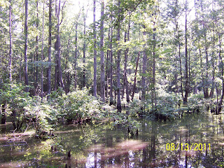
Swayback was peaceful as I entered the trail head on the Red Trail.  Serenaded by the ever-present passerines, I hiked by the Swamp and through corridors of scattered yellow and lavender wildflowers.  Flying insects were in abundance, though not too bothersome.  (I did use Repel on my boots and pants legs.)

Photos taken of several wildflowers.  Enjoyed the peaceful  and worshipful experience.

(My apologies on the pics.  I used my old Kodak Digicam (because of its light weight) rather than my normal dSLR.  Sacrificed quality of pic for weight on the trail.  Won't do that again.)


Friday, August 12, 2011

A Canine Hiking Companion


This is Griffin, Bernadette McKeever's trail running companion.  This photo was the first winner in the Wend Blog's Friday Photo contest. 

I know I enjoy having Gracie accompany me on hikes.  She seems to enjoy it so much.  It's a shame I can't take her during the summer -- too hot for her and too many ticks! 

Hang on Gracie... cooler weather is coming.  Wonder if she would like to try kayaking?...

Wednesday, August 03, 2011

Hot, Humid, and Hiking


Hike: Red Trail Swayback Bridge Trail of Legends, Wetumpka, AL, Wed., 08/03/2011, 06:25-09:45
Distance: 7 miles  Rating: 5/5
Difficulty: Easy to Moderate due to heat and humidity
Conditions: Hot (upper 80's to low 90's) and extremely humid.  Alabama Dept of Public Health issued a Heat Advisory for today.  Heat Index expected to be at or above 105 DegF.

Thoughts/Observations:

Numerous passerines (serenaded throughout the hike) as well as the ubiquitous summer-time bug.  I think I broke a spiderweb at least every 100' or so.  That's the price for being a "trail blazer" first thing in the morning!  Cicada (or locust) were loud in certain sections of the forest.

Trails were damp but only a few muddy spots required negotiation.

Forest was very peaceful.  Enjoyed the solitude.  (Met one mountain biker w/ his chocolate lab and one trail runner.)  Scripture on my mind this morning:  but whoever drinks of the water that I shall give him will never thirst. But the water that I shall give him will become in him a fountain of water springing up into everlasting life." John 4:14 (NKJV)  And "YOUR Name" by Phillips, Craig & Dean kept repeating in my spirit:

As morning dawns and evening fades
You inspire songs of praise
That rise from earth to touch Your heart
And glorify Your name

Your name
Is a strong and mighty tower
Your name
Is a shelter like no other
Your name
Let the nations sing it louder
'Cause nothing has the power to save
But Your name

Jesus, in Your name we pray
Come and fill our hearts today
Lord, give us strength to live for You
And glorify Your name

Tuesday, August 02, 2011

Second Day on the ATB

Bike Hike: Expanded Neighborhood Ride, Prattville, AL, Tue, 8/2/2011, 08:11-09:15
Distance: 11.6 miles  Rating: 4/5
Difficulty: Easy
Conditions: Mostly clear, hot, and very muggy.  No wind.  Little traffic.  Got off road in a few spots through puddles and sand/gravel mix.

Thoughts/Observations:

 Neighborhood ride again.  Got a later start this morning.  Felt a little "saddle sore" from yesterday - Yes, I have been off the bike too long.  Got off road in a few spots.  Even through some puddles and gravel.

Trying out a Zefel handlebar mirror.  Works okay, but I prefer the helmet mounted mirror.  Max speed: ~20mph  Avg speed: 9.7mph  Ride time: 1:11:00.

Linda's cardiologist appt is today I pray for her health and strength, for YOUR presence in her life.

Monday, August 01, 2011

Unleashed the Mountain Bike Again!

Bike Hike: Neighborhood Ride (Overlook I & II, Seasons, Sweet Ridge, Pleasant Ridge, Overlook Memorial Park), Prattville, AL, Mon. 08/01/2011
Distance: 10.5 (by GPS)  Rating: 4/5
Difficulty: Easy
Conditions: Mostly sunny, hot, and muggy (what would you expect for August?).  No wind.  Traffic very light to none.  City streets in good to excellent condition.  Only one dog encounter.

Thoughts/Observations:

Max speed: 20.6mph.  Avg speed: 10.0mph  Elevation Gain: 186ft

Nice ride through Overlook 1 & 2, Seasons, Sweet Ridge, Pleasant Ridge, and Overlook Memorial Park.  Felt the humidity this morning.  First time on the bike since October-2010.  Wow, it doesn't seem that long ago.  The tune up helped the shifting action, especially for the rear.  Can you believe it - one little Boston Terrier chased me for a few yards - he didn't catch me though!  Now I just have to ramp up to greater mileage again.  Want to do the Chief Ladiga Trail again this fall -- the autumn colors are extraordinary.

The lack of traffic helped to make this a peaceful ride.  Thank YOU, LORD, for YOUR gifts that are all around us.  Help us to open our eyes, ears, and hearts to receive them.